Friday, July 27, 2012

Work on Terry Hershey Trail Extension from Katy Fwy North to Addicks Dam underway (July 2012)


Terry Hershey Park & Trail parking lot located just South of I-10 provides access to Memorial Loop segment of Terry Hershey Trail, playgrounds, and future trail extension running North to Addicks Reservoir, which can be reached through underpass under Katy Freeway and feeder roads.

The underpass under Katy Freeway (Interstate 10) has been available for a while, but there was no trail
to speak of to continue on North to the Addicks Dam Road and Reservoir

Clearing work is underway on the segment North of I-10 running along Langham Creek
up to the flow control gate at Addicks Reservoir 


Meadow in the power line corridor making way for new trail

The gate house at the flow control gate on top of Addicks Dam

Clouds and high voltage pylons make for an awesome vista

Greater than normal water-release from Addicks Reservoir  into
Langham Creek, which will join up with Buffalo Bayou further down in Terry Hershey Trail
near Memorial Drive (7/25/2012)

The spillway at the Langham Creek flow control gate/weir at Addicks Dam
The rotten smell is awful! (July 25, 2012)


Patterson Rd. in Addicks Rervoir closed again due to high water (July 2012)


Watch for water on the road! - What road?
Glare: Looking West on Patterson Rd from intersection with N. Eldridge  late in the afternoon

A new lake has formed and submerged Patterson Road in Addicks Reservoir, but it won't last


Patterson Road transverses Addicks Reservoir East-West
and connects Highway 6 and N. Eldridge Parkway. It is subject to periodic flooding as the reservoir fills
with water after heavy rains which is being detained to protect Houston downstream


Wednesday, July 18, 2012

Addicks Reservoir at high water: Views from top of the Dam Road (July 17, 2012)


Anything but drought this summer: Rainwater flow-off from the Katy/Bear Creek area is draining to Addicks Reservoir and drowning the wilderness there, turning it into a huge lake, with a few trees sticking out here and there. 


What a contrast with just a year ago! 

Addicks Dam Gravel Road at Eldridge Parkway - Looking East (7/17/12)

Area rainwater accumulating in South-East corner
of Addicks Reservoir at Eldridge Parkway

Terry Hershey Extension Trail Project Coming Soon Sign
next to Eldridge Parkway on  South side of earthen Addicks Dam

Energy Corridor Office Buildings seen from the top of the Dam at Eldridge Pkwy

Addicks Dam Road - Looking East (July 17, 2012)

Detained Water at the Lanham Creek Flow Control Gate

Looking down into the reservoir from the Addicks Dam Road near the
Flow Control Gate: Electricity Pylon cum reflection (7/17/12)

Addicks Reservoir in July 2012 -
Built the The U.S. Army Corps of Engineers 80 or so years ago to protect Houston
from flooding during spells of heavy precipitation
Water flow control gate - Regulates water level
in Langham Creek, a tributary of Buffalo Bayou

Seasonal beauty with Energy Corridor Office Towers
in the background
Heading West on the Dam Road: Seasonal yellow flowers
in large bushes with Water Tower near Highway 6 in the background

Water Tower near Highway 6 close up against the cloudy sky

Addicks reservoir grounds covered in several feet of water
after mid-July storms - Photo taken from gravel road on the cusp of the dam


Tuesday, July 17, 2012

Spectacular sunset as water level rises in Addicks-Barker Reservoir after days of heavy rains (7/17/12 photos)


Scenic sun-down view of Barker Reservoir at high water level (7/16/12)

Reflection of a the evening sky and of the sphere-shaped crown of a tree
in the detained water

Sunflower against the evening sky

Sky with layers of red and yellow above the Barker Reservoir
tree line on July 16, 2012 at sunset

Buffalo Bayou water flow control gate at Barker Dam:
Massive amounts of water are backed up for later gradual release
to protect rain-soaked Houston downstream from flooding in the interim.
The  U.S. Corps of Engineers is monitoring the situation.

High water level (and rising) in Barker Reservoir (7/17/12)


View of Barker Reservoir from the gravel road on top of  the dam (7/16/12)
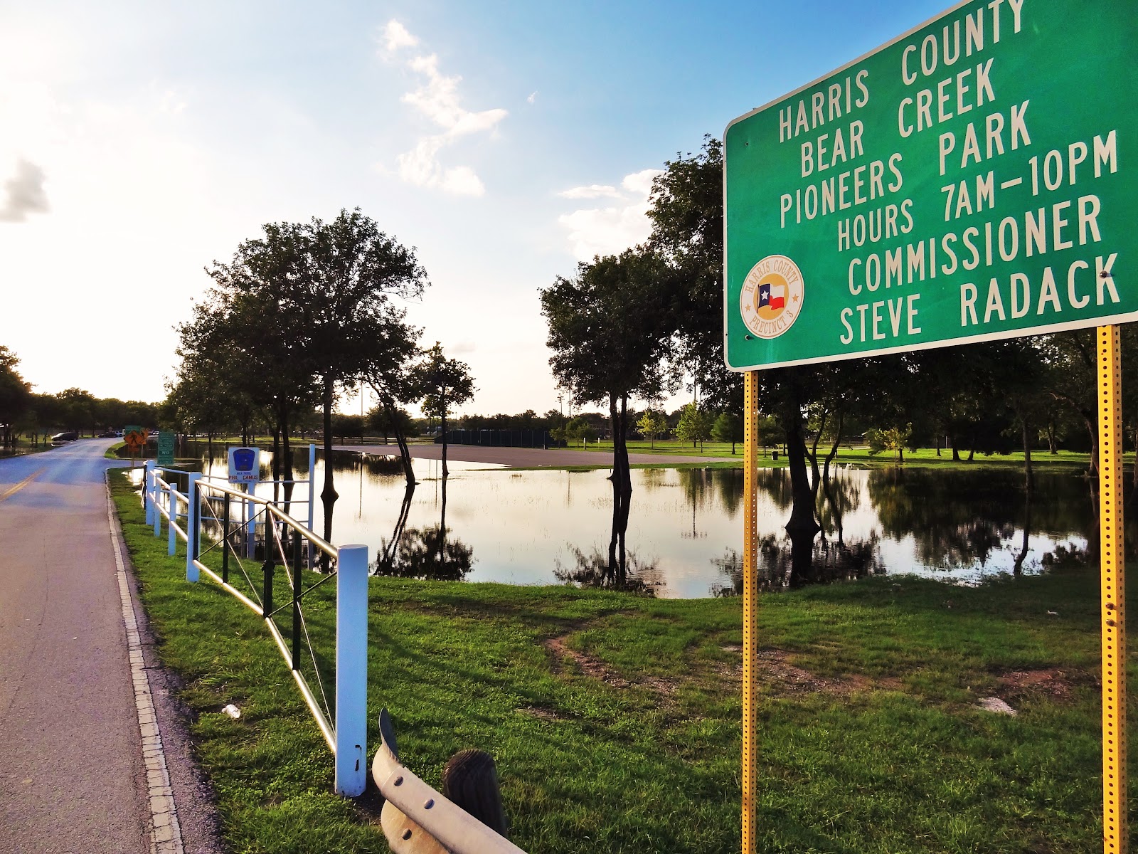
Eight inches of rain raised elevation of water surface in Barker Reservoir by a  few feet
(July 10-17, 2012)


View of detained water near the Flood Gate
Provisional data on rise of water surface inside the Barker Reservoir
from the U.S. Geological Survey (7/10/12 - 7/17/12)

At the Barker Dam Flow Control Gate (Buffalo Bayou)

North-East Section of Barker Reservoir - Photo taken from Dam
Monday, July 16, 2012 at 7pm


TEXT OF PRESS RELEASE FROM THE US ARMY CORPS OF ENGINEERS

USACE Galveston District monitors Addicks and Barker dams and reservoirs
U.S. Army Corps of Engineers, Galveston District

HOUSTON – The U.S. Army Corps of Engineers, Galveston District, is closely monitoring the Addicks and Barker dams and reservoirs in West Houston as part of stage one of an extended watch that calls for an increased surveillance of the flood risk management structures.

“The Addicks and Barker dams and reservoirs are performing as intended, which is to reduce the flood levels along Buffalo Bayou and protect the Houston Metropolitan area,” said Col. Christopher W. Sallese, USACE Galveston District commander. “Public safety is our number one priority as we work with our partners –the City of Houston, Fort Bend County, Harris County, and the Texas Department of Public Safety – to monitor the dams and reservoirs.”

The Corps remains in contact with the Texas Department of Transportation to provide status updates as the impoundment of rainwater in the Addicks Reservoir could result in flood water overtopping State Highway 6 between Clay Road and Interstate 10, which is located inside of the reservoir.
The USACE Galveston District staff will continue to closely monitor conditions and provide updates as the situation changes.

Constructed in the 1940s, both reservoirs are normally kept dry to preserve their overall capacity to impound storm water and reduce flood levels in Buffalo Bayou. When a rain event occurs, the gates are closed on the Addicks and Barker dams to reduce flooding below the reservoirs. When the downstream runoff has receded to non-damaging stages, reservoir operations resume, the gates are opened, and water is released.

Read more: http://www.dvidshub.net/news/91512/usace-galveston-district-monitors-addicks-and-barker-dams-and-reservoirs#ixzz20raBJToP


George Bush Park flooded (7/16/12)


Water level in George Bush Park / Barker Reservoir has been rising steadily and has already flooded stretches of Noble Road Trail. The lake has expanded beyond its usual banks. Part of the wilderness area is under water, trees partially submerged, with crowns above the surface. 


View from the top of Barker Dam in North-East corner of the reservoir

Noble Road seen from top of the Barker Dam near Briar Forest -
The lake has come risen above its banks

Flooded meadow at the George Bush Park Sign near Noble Road Trail Head
on the East end near the Barker Dam

Some water on the Nobel Road Trail inside the foliage tunnel 


Monday, July 16, 2012

School Demolition Pics: Maurice L. Wolfe Elementary


Old school building being torn down over the summer break.

Maurice L. Wolfe Elementary School  502 Addicks-Howell Road  Houston, TX 77079 


High water at Bear Creek Pioneer's Park July 15, 2012

Last week's drenching has markedly changed the vistas around Bear Creek Pioneer's Park, which is located inside the Addicks Reservoir; not to mention accessibility. War Memorial Drive was still passable Sunday during the day, but Patterson Road was under water and closed to traffic. The animals near the park administration building had been evacuated from their pens.

Bear Creek Pioneers Park - Flooded Parking Lot
off War Memorials Drive at Eldridge Parkway

N. Eldridge Parkway at War Memorials Drive:
Drainage Ditch close to full capacity


Flooded parking lot off War Memorial Drive

Mushrooms sprouting in drenched grass; Bison moved to higher ground

War Memorial Drive at Precint 3 Park Administration Building

View of flooded area from War Memorial Drive - Looking North to sports fields

Picnic table and bench surrounded by water

The birds seem to like it

At least the children's playground was spared

View of red barn and horseshoe throwing courts from across a temporary pond

Sports facilities under water

Making a splash upon leaving Bear Creek Park as it is being closed by
Harris County Precinct 3 Constable due to flooding
Constable clearing Bear Creek Pioneers Park because of high water
Flooded picnic station at sunset

Picnic table and benches ended up in the middle of a pond