Showing posts sorted by relevance for query Patterson road. Sort by date Show all posts

Monday, August 13, 2012

Crossing Addicks Reservoir via Patterson Road

Gate at Houston Farm & Ranch Club: Patterson at Abercrombie
Patterson Road sign at signalized intersection with Highway 6 (SH-6)
near Houston Farm & Ranch Club and Bear Creek Pioneers Park
Back-lit trees alongside Patterson Road late in the afternoon
Patterson Rd. connects N. Eldridge and Highway 6 through the Addicks Reservoir (when it's not flooded)


Map of portion of Addicks Reservoir showing Patterson Road connection from Highway 6 to North Eldridge Parkway
(Google satellite view with thumbnails of geo-tagged Panoramio photos)

Saturday, August 11, 2012

Texas Longhorn Cattle at Houston Farm & Ranch (pictures)

Houston Farm and Ranch Club Trail Rider Wagon at the 2013 Rodeo Parade in Downtown
(photo added 2/25/2013)
Houston Farm and Ranch Club - Gate at Patterson Road (September 2012 photo)

Grazing Longhorn on pasture in Addicks Reservoir near Patterson Road
- Harris County Community Center (Bear Creek) in the background


Houston Farm & Ranch Gate at Abercrombie and Patterson Road near Highway 6
inside Addicks Reservoir . Address: 1 Abercrombie Dr Houston, TX 77084

Bull grazing on wet pasture at Houston Farm & Ranch Club
Longhorn Cattle at Bear Creek Pioneers Park 
Pasture near Harris County Bear Creek Community Center / County Agricultural Extension Building
near State Highway 6 and Patterson Road


Sunday, March 13, 2016

Patterson Road in Addicks Reservoir under water again after last week's heavy rains (March 13, 2016 photos)


It typically happens several times a year, and the road that runs East-West through the flood-control reservoir gets closed to traffic. What's less common is that drivers take a chance when the water level is rising after heavy rains and end up in the ditch, or get swept away before the closure. Happened last year; just happened again, as the above photo attests.


Flooded field at Bear Creek Driave in Addicks Reservoir


Pasture at Houston Farm & Ranch Club
at Bear Creek Park 
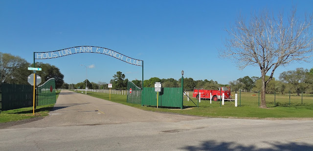
Gate of Houston Farm & Ranch Club on Patterson Road

This area is at a higher elevation and was not affected by the flooding 
Vintage fire engine parked in a green pasture at Bear Creek Pioneers Park
Vintage fire truck out on pasture 
Fire arms restriction posted on federal lands
Addicks reservoir is federal territory - Fire arms restriction 


Friday, July 27, 2012

Patterson Rd. in Addicks Rervoir closed again due to high water (July 2012)


Watch for water on the road! - What road?
Glare: Looking West on Patterson Rd from intersection with N. Eldridge  late in the afternoon

A new lake has formed and submerged Patterson Road in Addicks Reservoir, but it won't last


Patterson Road transverses Addicks Reservoir East-West
and connects Highway 6 and N. Eldridge Parkway. It is subject to periodic flooding as the reservoir fills
with water after heavy rains which is being detained to protect Houston downstream


Friday, September 21, 2012

Addicks Texas: Old German Church (United Methodist) Kirche deutscher Einwanderer in West Houston

German Church at Night - Addicks West Houston TX
Steeple of modern version of Addicks-Bear Creek area church founded by German Pioneers in the 1800s
Historical background for church founded by German Immigrants on plaque in front of the Church Building
Historischer Hintergrund zur von deutschen Immigranten gegruendeten Kirche
Addicks United Methodist Church in the shadow of the Highway 6 Overpass
1212 Texas 6 Houston, TX 77084 U.S.A.
Addicks United Methodist Church on SH-6 at Park Row - Sign with worship schedule and motto:
"The Little Church With A Big Heart"
(Kleine Kirche mit grossem Herz)
Addicks United  Methodist - Church founded by German Settlers - on the Google Map
(Satellite view with thumbnail photo)

The church was originally located farther to the North inside what is today Addicks Reservoir, but was destroyed in a flooding. Three cemeteries with the remains of German settlers or their descendants are on reservoir grounds, one at the corner of Highway 6 and Patterson Road, which is still being used and therefore has recent graves, another one off an abandoned road running parallel to North Eldridge (at lower elevation) and the third one -- known as the Koch-Schmidt Cemetery -- is located close to the West Houston Airport South of Groeschke Road in Cullen Park Phase 4 South of the picnic and playground areas.

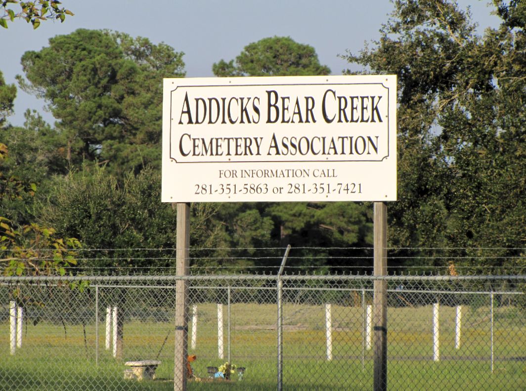
Addicks Bear Creek Cemetery of German immigrants and their descendants


One of three cemeteries inside what is now Addicks Reservoir. This one, located on the corner of Highway 6 and Patterson Road (near the Houston Farm and Ranch Club facilities), is still in use. The original Methodist Church was located here, but moved South because of the periodic flooding. 


Wednesday, February 20, 2013

Eldridge at Katy Freeway Prime Office Space Development - Ground broken (construction pics)

Backhoe at N. Eldridge Pkwy - Katy Freeway site of new office development project

Construction work (earth-moving and utilities installation work, to be more specific) has commenced on Energy Corridor office building development project that will bring to the West-Houston sub-market more than half a million rentable square feet of premium office space at the SW corner of North Eldridge Parkway and Katy Freeway. <-- Follow link to prior blog post with on-location pics of project site. 


This stretch of Eldridge Pkwy just North of Memorial Drive recently saw completion of a road widening road project (additional lanes added), and further road improvements are being implemented on the North side of Interstate 10 on the stretch that runs through the Addicks Reservoir wilderness and connects to Patterson Road, War Memorial Drive (Bear Creek Pioneers Park), and Clay Road, which has proven to be extremely dangerous and accident-prone, especially in wet conditions at night.  


Photo of pre-leasing sign by office property leasing agent with dirt pile at construction site behind it
CBRE Leasing Agent sign and rendition (computer-generated image)
of new office building being erected
at N. Eldridge Pkwy South of  I-10 Katy Fwy inbound feeder road

Monday, September 24, 2012

Cullen Park Hike & Bike Trail in September (photo tour)

Birdhouse on the Prairie

Tree-lined section of Cullen Hike & Bike Trail (paved throughout)

Edge of meadow along Cullen Park Hike & Bike Trail near the West Houston Airport

Yellowish-green berries hanging from small tree seen against the blue sky over the prairie land
South of the runway at West Houston Airport

Looking up - Twigs with double-rows of leaves make for nice profile against the sky
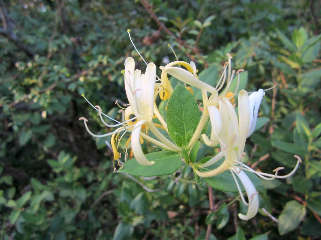
Red Trumpet flowers with seed pods on the same twig

Bushy-hairy grass stalks on the edge of the meadow alongside the hike and bike trail

Majestic Oaks (my best guess) at the historic grave site where members of German pioneer families
who settled in the Addicks-Bear Creek  in the 1800's area are buried

A few of the gravestones with German inscriptions at the Koch-Schmidt Cemetery

Picnic tables and gazebo at one of the park and playground areas with facilities
in Cullen Park / Addicks Reservoir (near the burial grounds of the German Pioneers that settled the area )

Kids playground along Cullen Hike & Bike Trail with a few rays of sun in the late afternoon
(accessible via the trail or by car, with parking lot and amenities for visitors nearby)
Orange butterfly with white specks under the wings. It had landed on a stalk in the grass
and was flipping its wings as if to show off to colorful patterns on both the top and bottom sides.
Sunlit vegetation on a late afternoon at bend in the Cullen Trail
near the East End at Highway 6 / Patterson Road
Heading West on Cullen Trail in the late afternoon:
Backlit foliage and tree branches 


Cullen Hike & Bike Trail - Trailhead on the East End (at Highway 6 at Patterson Road) with Signs