Showing posts with label Addicks Dam. Show all posts

Sunday, October 16, 2016

Addicks Dam Road and Hike and Bike Trail remains closed due to ongoing repair work


The Extension of the Terry Hershey Hike & Bike Trail North to Addicks Dam remains off limits for hikers and bikers as repair work continues at the outlet structure and elsewhere along the earthen dam, which has been rated righ-risk, but successfully held back record-breaking amounts of water during the heavy rains earlier in the year. The high water level in the reservoir led to the closure of both North Eldridge and Highway 6 for weeks, and turned Bear Creek Pioneers Park into a lake.   


 This stretch of North Eldridge behind the Dam was closed for weeks during the flooding 
earlier this year.


Hike & Bike Trail Closure - Terry Hershey Trail Extension to Addicks Dam
PEDESTRIANS AND BICYCLES PROHIBITED 

Tuesday, May 28, 2013

Mexican Hats on Addicks Dam


The vegetation on the slopes of Addicks Dam varies somewhat with the seasons. This time of the year patches of yellow prairie coneflowers -- aptly called Mexican Hat in recognition of their sombrero-like flower heads -- enliven the green meadows and complement the panorama of tall prairie grasses swaying in the wind.

Prairie grasses and cone flowers with Addicks Reservoir grounds in the background


 Scientific name: Ratibida columnifera aka Ratibida columnaris


Thursday, January 31, 2013

Trail Extension to Addicks Dam and West to Highway 6 (Jan 2013 construction pic update)


NEW COMMUTING OPTION FOR ENERGY CORRIDOR 
BICYCLE RIDERS IN THE WORKS

Construction work continues on the extension of the Terry Hershey Trail system to connect to the Addicks Dam Road, or rather to a new hike and bike trail being built at the base of the Southern (outside) slope of the dam that will continue on westward to Highway 6, and will provide a new route for bike commuters to  and from corporate campuses and energy corridor office buildings.

Here are a few pics taken this month (January 2013) illustrating the status of ongoing earth-moving and construction activity at various points between Terry Hershey Park / Memorial Loop Trail and Addicks Dam, including a panoramic view of the scene at the flow control gate where the reservoir empties into Langham Creek.  


Wednesday, November 14, 2012

Variations of Highway 6 Signage and Texas State Highway Theme Images


Texas 6 - Old State Highway 6 road signage is still up - newer signs show "SH 6"


Highway 6 southbound lane at Addicks Reservoir Dam
BP's corporate campus seen from across Highway 6
Photo of water tower shot across SH-6 - Addicks Dam at center (green)


Thursday, October 25, 2012

Texas Armadillos - One live, One roadkill, One natural history museum exhibit

Armadillo on top of Addicks Dam Road at sundown
Armadillo shell exhibit at Houston Arboretum
A common road-side sight in Texas: Shell of dead Armadillo - The head
 and innards are gone; likely an indication that the carrion-eating vultures
 may have already had a go at the carcass. 
Vultures perching on tree branches

Friday, September 21, 2012

Dam wildlife is awesome - Photo safari on Addicks Dam Road


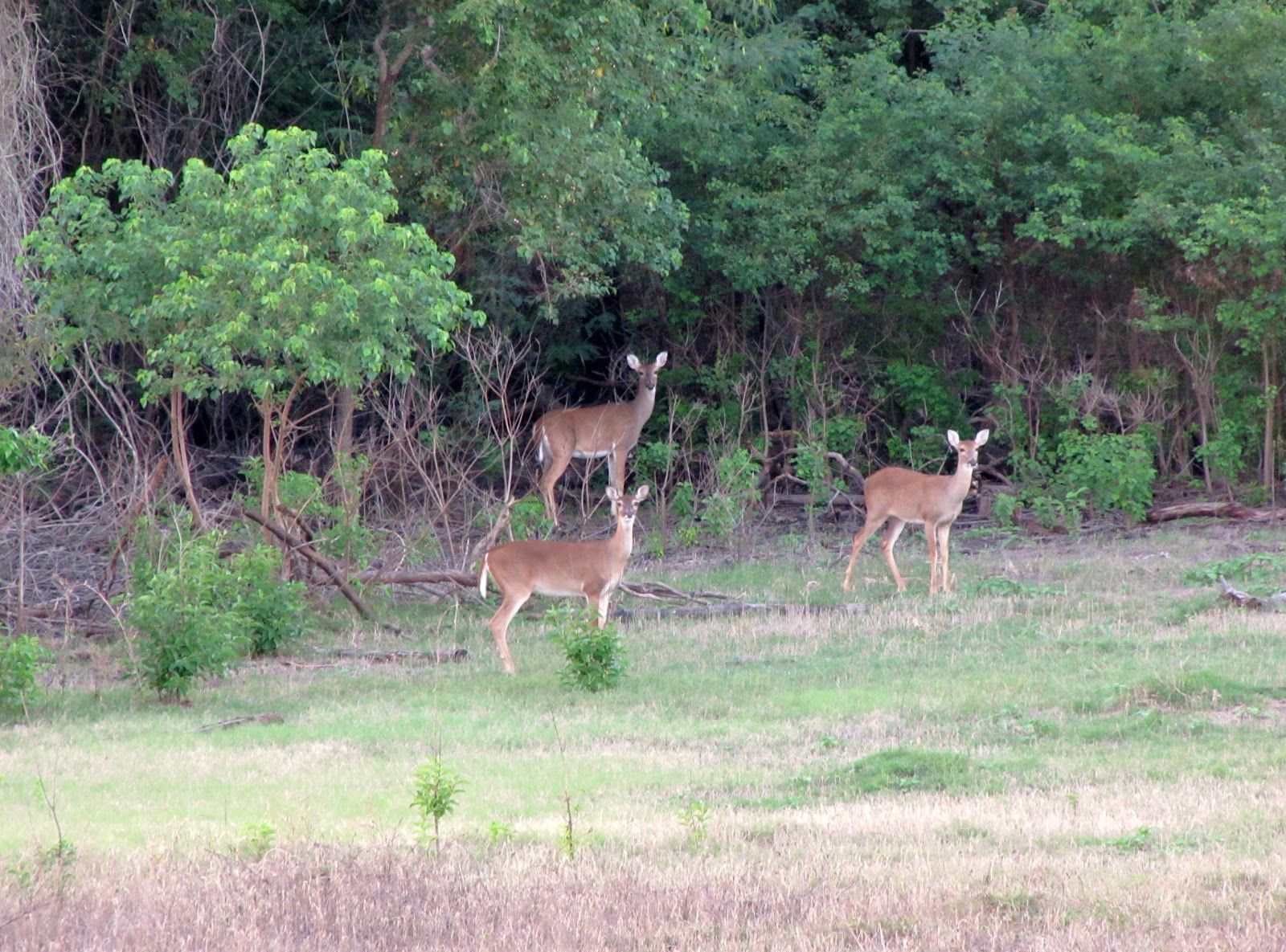
Addicks Dam protects the City of Houston from flooding after heavy rains. What is less well known is that the earthen dam with a gravel road on top also affords an excellent opportunity not only for walking and hiking (one stretch even has exercise equipment, albeit not as fancy was what is installed along Terry Hershey Trail) -- but for enjoying native wild life.This includes not only butterflies and sundry bugs, insects, and birds, but also large mammals: most notably deer - even groups of deer. Here are three on the edge of a wooded area, taken with tele-lens in the late afternoon (contrast and sharpness enhanced with photo editing software). 


All ears and staring at the Canon shooter (PowerShot SX 20 - ISO 400  f/5.7  1/20 sec.)

Buckeye resting on a tall grass


Not to mention the bounties of the colorful flora -- which changes over the course of Spring, Summer, and Fall - the butterflies that the flowers attract, and the simple beauty of the tall grasses. 

Flowers with bugs...looks like caterpillars

Even the gravel road plays host to beautiful living things

Indian Paintbrush amid high grass on the slope of Addicks Dam

Sensitive Briar 

Because of its elevation in what is an essentially flat landscape, Addicks Dam Road also offers nice sunsets, although the Barker Dam does better in that regard because it runs North-South with tree-line on the horizon, rather than East-West as Addicks Dam does [in the Energy Corridor segment], and also even has a lake to catch the setting sun's reflection. 


Addicks Dam Panorama from State Highway 6 (aka SH-6)

Addicks Dam and water tower seen from across Highway 6  -  Memorial Medical Tower in the Distance

Tuesday, August 28, 2012

BP presence in West Houston Energy Corridor: Photos & Map

BP Office Buildings at Helios Plaza and Westlake Park -
Teleshot across the freeway from outbound Katy Freeway feeder road
BP Office Buildings (both Helios Plaza and Westlake)
on its West Houston campus in its green setting

British Petroleum America West Houston Campus on the GoogleMap (satellite view with pics)

BP Office Buildings seen from top of Addicks Dam looking Southwest
Electricity transformers at sub-station in foreground