Showing posts with label signs-and-traces-of-area-history. Show all posts

Friday, January 24, 2014

The story of the train that once ran through George Bush Park and connected the ranches in Barker and Katy to Houston

This interpretive poster with an old black-and-white photograph of a steam-engine-drawn train and people on top, erected on the edge of the equestrian area parking lot, tells the tale of the small-gauge rail line that in pioneer days traversed the area now known as George Bush Park and connected it to Houston, which was then but a small town on the Bayou. 

A train one ran through the ranchland that is now wilderness
Relics and reminders of life before the U.S. Army Corps of Engineers 
built the dam and converted the ranch land to a reservoir can be seen throughout 
the wilderness area; some even along the paved trails running through the reservoir.


For those interested in the role railroad played in the settlement and development of the area, there is a railroad museum in nearby Richmond, TX, Fort Bend County, which may be worth a day trip.

A surviving specimen of a full-sized Southern Pacific steam locomotive can be seen in Downtown Houston. It is on display on a lot between George R. Brown Convention Center and MinuteMaid Ballpark Stadium.

Southern Pacific Steam Engine at site of future Nau Center
at MinuteMaid Park and Downtown Houston Convention Center


Saturday, November 2, 2013

Historic West Houston cemeteries and grave sites


Graves of members of German settler families in Bear Creek - Addicks area
The cemetery is US property because it is located on Addicks Reservoir grounds,
a project of the US Army Corps of Engineers
Koch-Schmidt Cemetery Marker with historical background info
Koch-Schmidt Cemetery South of Groeschke Rd is framed by large trees
and almost invisible from the park road to the pavilions, playground, and recreational spaces
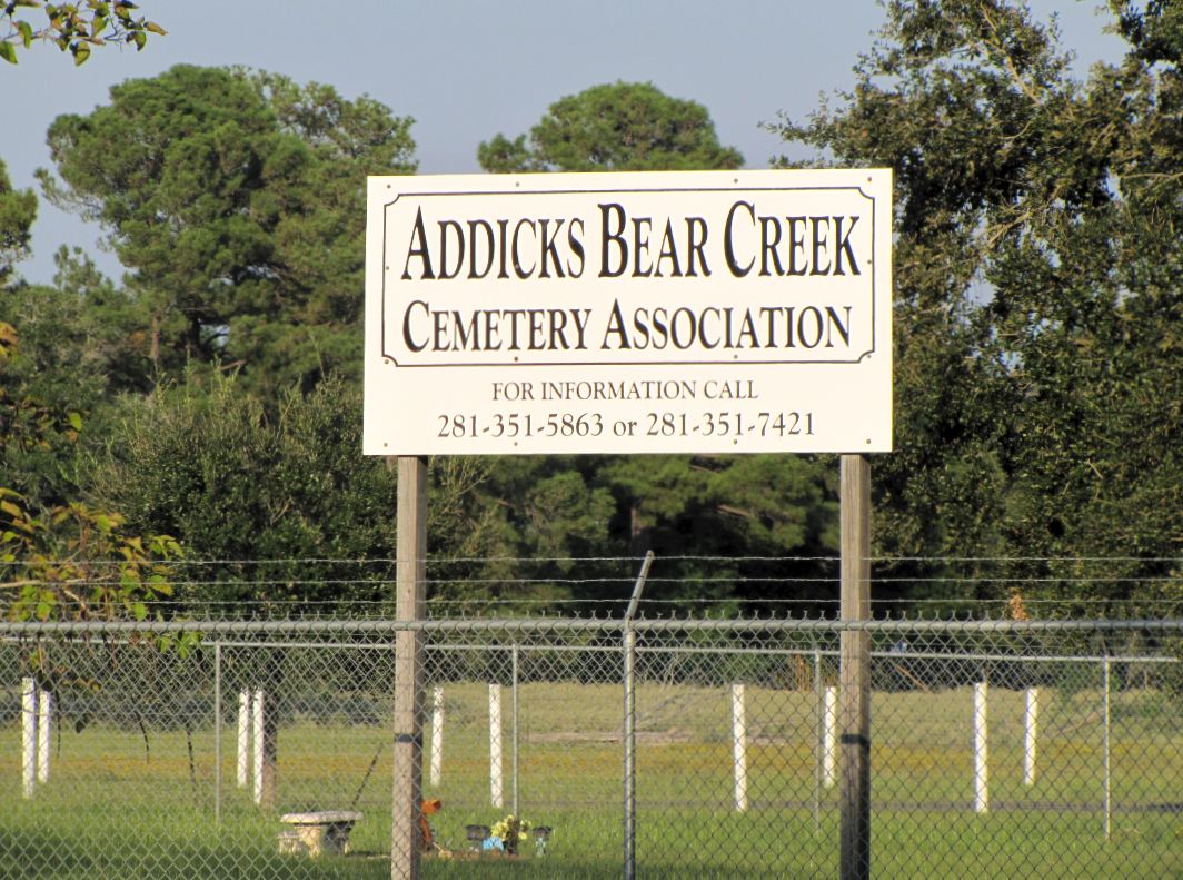
Bear Creek / Addicks cemetery on SH-6 at Houston Farm & Ranch Club ground
with historical marker. Unlike two other nearby cemeteries inside the Addicks Reservoir,
this one is still in use.
Enclosed grave site at Beeler Family Memorial Park on Enclave


Beeler Family traces around Addicks and Barker, TX (Energy Corridor)


Beeler Rd - Street sign in George Bush Park at Equestrian Area Parking Lot
Amanda Beeler's leaning grave stone
Beeler Family Cemetery on Enclave Parkway

Pocket Park on Enclave Pkwy with site of old graves 

Pocket Park with family cemetery on Enclave Parkway


Beeler Memorial Pocket Park on Enclave Parkway near Corporate Campuses


This is a small park off Enclave Parkway (ca 1 acre) that was excluded from the corporate office building developments nearby because it is the site where members of a local family that settled and farmed the land are buried.

Tomb stones in Beeler Family Cemetery on Enclave Parkway
Pocket Park on Enclave Parkway in Energy Corridor with Grave Site


Friday, January 4, 2013

The LH7 Brand - Texas Longhorn Cattle Ranch once operated in Barker, Texas


George Bush Park was once part of a large cattle ranch. 


Much of the ranch land later became Barker Reservoir, built to hold back water from heavy rains upstream to prevent flooding downstream in the City of Houston. 

The site of the Marks LH7 Ranch buildings today has a historical marker to commemorate its glorious past. Even the Houston Rodeo has its roots here. 


Plaque providing historical information on LH7 Ranch in Barker Texas
LH7 Ranch Texas Historical Commission Marker
LH7 Ranch Texas Historial Site in West Houston / Katy Area
These structures - a church, a general store and post office, and other farm buildings stand on the property today. They may not be original buildings that were part of the Ranch when it was operating, or were moved.
(I converted the digital photo taken 1/3/2013 to black & white to give an historic postcard-like look.) 


Satellite view of LH7 ranch site at Kingsland Blvd. / Barker-Clodine Rd. with small photo of ranch gate
and church building


Silhouette of windmill at Barker evokes Katy area's ranching past


Windmill at former site of LH7 Ranch on what is now Barker Reservoir
It's actually not a mill. The wind-energy was used to power a water pump
Erstwhile Barker General Store and Post Office seen across the fields
Gate at Marks LH7 Ranch (also written as _H7  to render the shape of the brand mark more accurately)
with church and farm buildings in back behind. Although the original meaning has fallen into disuse, brands
were used to mark ownership of cattle to allow for easier identification in the event of cattle theft, and thus deter it.
Texas Historical Commission marker  and interpretive poster at site of former LH7 Ranch at Barker Reservoir
located a bit South of Katy Freeway off stretch of Barker-Clodine Road (now a cul de sac because the section running down to Westheimer Parkway is closed to motor traffic.)
Annotated aerial view of _H7 Ranch Buildings with historical photographs of rancher and longhorn cattle


Sunday, September 23, 2012

Koch-Schmidt Cemetery (Friedhof in German) - Graves of German settlers in Addicks Reservoir - Graeber deutscher Einwanderer


Historical marker at Koch-Schmidt Cemetery in Addicks Reservoir / Cullen Park. Gedenktafel mit den Namen der hier bestatteten Mitgliedern der Gruenderfamien deutscher Herkunft.


This historical grave site contains the earthly remains of early German immigrants who settled in the Addicks-Bear Creek Area in the 1800's and also founded the Bear Creek German Methodist Church. Names of immigrant families include Adicks, Ankele, Gastmann, Groeschke, Hoffman, Leier, Matzke, Mueller, and Schmidt.  
Pastor's gravestone towering over those of the flock

View of German settler graves through the chain-link fence

Fallen tree with Spanish moss between cemetery and one of the Cullen Park picnic and playground areas (Phase 4)
West Harris County near Groeschke Road / West Houston Airport

The German immigrant families that settled on Bear Creek also founded a German Methodist Church. Its current incarnation has its church building South of the Addicks Reservoir on Highway 6 at Park Row, with spire and weather vane. 


Die deutschen Einwandererfamilien gruendeten auch eine protestantische Gemeinde und errichteten ein Kirchengebaeude. Die heutige Version der Methodistenkirche befindet sich suedlich vom Reservoir einen Block von der heutigen I-10 Autobahn entfernt. Das urspruengliche Gebaeude fiel einer Ueberschwemmung zum Opfer. Um eine Wiederholung zu verhindern, wurde die Kirche ausserhalb des Ueberschwemmungsgebietes wieder-aufgebaut. 


Friday, September 21, 2012

Addicks Texas: Old German Church (United Methodist) Kirche deutscher Einwanderer in West Houston

German Church at Night - Addicks West Houston TX
Steeple of modern version of Addicks-Bear Creek area church founded by German Pioneers in the 1800s
Historical background for church founded by German Immigrants on plaque in front of the Church Building
Historischer Hintergrund zur von deutschen Immigranten gegruendeten Kirche
Addicks United Methodist Church in the shadow of the Highway 6 Overpass
1212 Texas 6 Houston, TX 77084 U.S.A.
Addicks United Methodist Church on SH-6 at Park Row - Sign with worship schedule and motto:
"The Little Church With A Big Heart"
(Kleine Kirche mit grossem Herz)
Addicks United  Methodist - Church founded by German Settlers - on the Google Map
(Satellite view with thumbnail photo)

The church was originally located farther to the North inside what is today Addicks Reservoir, but was destroyed in a flooding. Three cemeteries with the remains of German settlers or their descendants are on reservoir grounds, one at the corner of Highway 6 and Patterson Road, which is still being used and therefore has recent graves, another one off an abandoned road running parallel to North Eldridge (at lower elevation) and the third one -- known as the Koch-Schmidt Cemetery -- is located close to the West Houston Airport South of Groeschke Road in Cullen Park Phase 4 South of the picnic and playground areas.

Addicks Bear Creek Cemetery of German immigrants and their descendants


One of three cemeteries inside what is now Addicks Reservoir. This one, located on the corner of Highway 6 and Patterson Road (near the Houston Farm and Ranch Club facilities), is still in use. The original Methodist Church was located here, but moved South because of the periodic flooding.