Showing posts with label parks-and-recreation. Show all posts

Thursday, February 25, 2016

Schiller Hill offers panoramic views, in addition to opportunities for exercising and bird-watching


The hill is a man-made elevation located South of Schiller Road between Highway 6 and Eldridge that is part of a flood-control measure developed to reduce damage downstream of Brays Bayou. The hill was created with dirt excavated from below to enlarge the capacity of the stormwater detention pond. The entire flood controls project space is also a designated recreation area with paved trails for walking, hiking, and biking, and has recently been equipped with trail-side exercises stations. Fishing is also allowed, although certain limitation apply. Boating is not allowed and alligator warnings are posted. The two large permanent bodies of water feature small islands and attract many birds, including egrets, herons, double-crested cormorants, coots, ducks, ibises, and even pelicans. The lakes support large birds because they contain an ample population of fish.


A pair of Ibises with their characteristic sickle-shaped bills  
The shores are designated as Stormwater Treatment Wetlands 
Apart from the Baker Dam farther North, which was also build as a flood-control project, Schiller Hill is the highest elevation in the area and affords a 360 degree view for the surrounding suburban landscape. To the West and South, the view is not particularly scenic because of the presence of Highway 6 and the Westpark toll road, respectively, and warehouse-type structures.


On days with good visibility, however, the Downtown Houston skyline can be seen on the horizon on the North-East side, in addition to the office towers near the West Belt and on Richmond, and the Williams Tower and other tall structures in the Galleria area on the West Loop. The most salient nearby landmark is the water tower on Eldridge, located South of the playground area.


The hill is now completely covered with grass, as are the slopes of the expanded stormwater detention basin. A few small trees have also been planted. Swings and picnic tables invite visitors to stay and relax, while enjoying the unobstructed view of the land and water below.


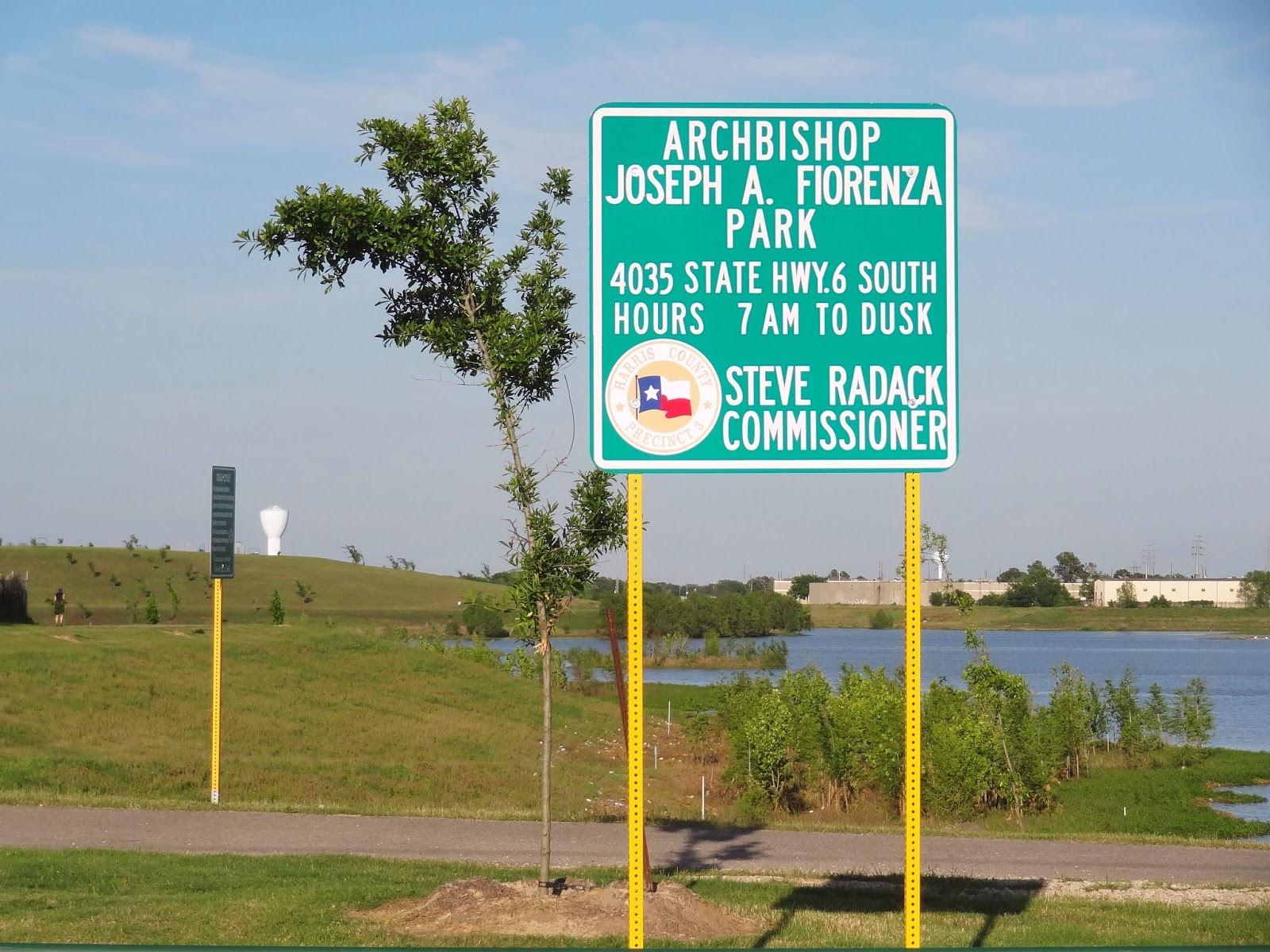
The park, named after Archbishop Fiorina, and its now extensive system of paved trails, are quite popular, but due to its large size -- spanning the full distance between Highway 6 and Eldridge Parkway - it is never really crowded, except for the children's playground area at the entrance on Eldridge, which is also where amenities such as restrooms and water fountains are located, in addition to park benches.

Trailhead at Highway 6 (but no parking) 
Schiller Hill is best accessed from Highway 6, by making a turn at the ALDI store and going East on Schiller Road. This road is a cul de sac.


It eventually ends near the edge of the water. But a sizable paved parking area was leveled and paved at the foot of hill in 2015 specifically for use by park visitors. It accommodates 60+ vehicles, but is never filled to capacity. At the Eldridge Parkway entrance to the park, by contrast, parking can become an issue, depending on the time of day and weather conditions.

New parking lot for park users to the South of Schiller Road 
Step-Up Instruction at the foot of the hill 
Sunset at the Lake (Feb 25, 2016)
MORE SCHILLER HILL AND LAKE PHOTOS FROM LAST YEAR 

Trail rules posted at the Schiller Road Parking lot
at the foot of the hill (July 2015) 
Trail that curves around the base of the hill with cyclist on the cusp (July 2015) 
White pelican on the storm water detention lake 
Three ibises in flight 
Stormwater Treatment Wetlands (April 2015) 
View from Schiller Hill across the stormwater detention lake
with Houston skyline in the distance (April 2015) 


Saturday, September 26, 2015

Yes, you can see white pelicans in the wild in Houston


Here is the proof: The pelicans are back at the "water hole" between Highway 6 and Eldridge at West Park. Built for flood control purposes, and recently enlarged, this man-made lake has become popular with local residents for walking and biking shore-side, but also with birds. Their favorite spots are the little islands where no humans bother them. As was true in the Spring, though, great white egrets and ibises are more common than pelicans. You will need a powerful zoom lens to get close-up shots. 

Detention pond island birds: White egret, American white pelicans, more egrets 
Detention pond islands in the late afternoon (Sep 2015)
Great white egret strutting in shallow water 
Sunset at the detention pond 

Tuesday, July 15, 2014

Hiking Trail Signs

Biker vs hiker: Who has the right of way? 
Harris County Commissoner's Sign urging park users to keep parks clean
(posted at Sports Park at Barker-Cypress corner of Barker Reservoir)
Nobel Road Trail - Signs at Trailhead
Slippery bridge (when wet) warning sign along Terry Hershey Trail
Terry Hershey Trail Etiquette Rules
Posted speed limit for bikers when passing hikers: 10 MPH
Gator warning in Memorial Park
near Bayou habitat observation deck
Nature Area advisory in George Bush Park at Buffalo Bayou
boardwalk and bridge


Sunday, July 13, 2014

Ideas for boy scout public service projects in George Bush Park


Scouting challenge: Educate recreational Bush Park visitors about reservoir hazards and how to avoid or mitigate them while enjoying wilderness and wildlife 

A sign at the trailhead of Noble Road Trail in the Barker Reservoir warns of unspecified dangers of wildlife: Beware of harzardous plant and animals. The warning it about as useful as your Mother's erstwhile "be careful" send-offs on your daily walk to the neighborhood elementary school, or a friend's friendly good-bye in the form of an all-purpose recommendation to "take care".


What should we watch out for and take care of when exploring the Bayou and heading into the woods? What is there to be careful of? What are the does and donts? To be sure, you could stay out of the wilderness altogether to avoid any and all risks, known or suspected, but you would miss all of the wonders of the wilderness and its wildlife, the charms of the landscape, whether dominated by lush greens or variations of orange and rust, not to mention a great chance to exercise and do something for your health no matter what time of the year.

Here is where the boyscout projects come in: Identify and explain on posters the known and unknown dangers in the reservoir, and the best way to deal with them. Like how to avoid stepping on snakes and when  and where to expect them on the ground in the first instance. And while we are on the topic of snakes. There is precedent for interpretive posters with pics  already a bit further north: at the equestrian area in Bear Creek Pioneers Park (Addicks Reservoir).


What other perils may be lurking in the suburban wilderness? Anything else that's poisonous if not venomous? What about poisonous plants (poison oak, poison ivy, and so one)? What about wild berries? And how about the feral hogs? Are they to be feared? Do they ever charge humans? Not to mention mosquitos and other insects during the hot and humid months? If you find a dead animal on the ground, with flies buzzing around, should you report it, or let the area vultures do the clean-up work? Is there any risk in approaching for a closer look? What about rabies? Should that be a concern?

And how do you report an emergency, or just useful information about something unusual that may need attention, and report your location? Which takes us to another topic: George Bush Park is so vast, it needs markers and names for better orientation. There are several permanent bodies of water inside the reservoir, for example. None of them has  a name. And the same goes for the many trails, with the exception of Noble Road Trail. Even the North-South paved bike and hike trial has no name posted, notwithstanding the fact that it used to be a regular road connecting two settlements. It should at least be identified as Barker-Clodine Trail.

Boy scout troops have already improved the park with wooden benches along trails and on the shores of the ponds. There is even a wooden panel with a trail map at the West end of Noble Road Trail that was placed there years ago and is now weathered.

There are many projects awaiting volunteers, to benefit the public, or at least that segment of the public that shares the scout's commitment to the outdoors and appreciation of nature, and wants to enjoy it with safety in mind.

OTHER SIGNS OF PAST BOY SCOUT PUBLIC SERVICE PROJECTS IN THE RESERVOIRS: 

Crude area map on wood panel at Western trailhead
of Noble Road Trail in Barker Reservoir 
Bench built by scouts on the Lake North of Noble Road Trail invites quiet contemplation of scenic view
with great white egret across the water
Another trail-side bench built by a scout troop as a community service project