
Showing posts with label nature-conservation. Show all posts
Showing posts with label nature-conservation. Show all posts
Saturday, October 4, 2014

Wednesday, February 27, 2013
Wetlands Restoration Area in Barker Reservoir


 |
| Treeline and ditch on side of Noble Road Trail looking West (Feb 2013 photo) |
Thursday, February 7, 2013
Buffalo Bayou without buffaloes - American Bison hard to find these days
Where have all the Buffaloes gone?

Not sure who gave Buffalo Bayou its name and whether the
obvious explanation holds water. The American Bison was once abundant
throughout North America and the largest land-borne mammal. Thanks to
industrial-scale slaughter at the hands of the white man, the bison was almost
on the brink of extinction in the early part of the past century when
conservation efforts were finally undertaken to preserve the iconic American
beast and assure its survival.

 While Buffalo Bayou teems with other wildlife, there are no buffalo anywhere to be seen on its banks today except for the word “Buffalo” on bayou name markers on roads, bridges, and trails, and some commercial signs of companies that have appropriated the name.
But a few specimen of the iconic large grazer that once
roamed the vast lands from Canada to Mexico in huge herds can be seen at Bear
Creek Pioneers Park, which also hosts a number of other native and more exotic species, most notably birds, along with ponies, donkeys, sheep and goats.

But Bear Creek, as much as Buffalo Bayou, may be have become a misnomer as civilization encroached on the wilderness and natural habitats. The bears at Bear Creek seem to have gone the way of the buffalo on the banks of the Buffalo Bayou; and there aren’t even any in the fenced areas and pens that house other animals there, including the two live exemplars of American Bison and farm animals such as goats and sheep.
 |
| Texas Buffaloes on the Map - Bear Creek Pioneers Park with animal pens and pastures in West Houston |
Saturday, January 26, 2013
Why George Bush Park?
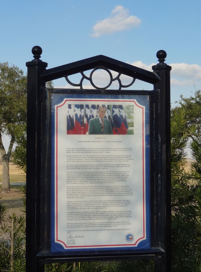
How did Bush Park get its name? It's not the bushes, no. Just one Bush, with capital letter. The elder.

A poster in the section of the park South of Westheimer Parkway explains the role of former president George H.W. Bush -- along with Terry Hershey (for whom the park along the bayou is named) -- in preserving natural habitat and preventing Buffalo Bayou from being channelized -- i.e. straightened and its banks lined with concrete -- like other bayous in the greater Houston area.
 |
| George Bush Park Map with trails and facilities shown (click to enlarge) |
The 41st President of the United States is also being honored elsewhere in the City of Houston. Downtown, there is a George Bush Monument that has him (or rather a statute of him) looking over the Bayou, and there is also a Presidential Grove at Memorial Park. Current President Obama has a mural of his image in Midtown near the Breakfast Club restaurant, but it has been defaced already several times, and had to be redone by the artist.

 |
| George Herbert Walker Bush Memorial |
Wednesday, November 7, 2012
Comeback of George Bush Park Wilderness after the 2011 Wildfire
Miles Lease gravel road inside George
Bush Park

Wetlands Restoration Area inside the Barker Reservoir
South of Noble Road Trail behind Barker Dam

This trail runs along the perimeter of the US Army Corps of Engineers officially designated Wetlands Restoration Area inside George Bush Park. It is essentially a cul-de-sac and even less traveled by humans than Noble Road Trail, from which it branches off at a right angle near the edges of the a lake to the North and the better known one to the South, which is visible from the top of the dam, has a number of benches and open meadow area along its shores.

The lake to the South of Noble Road is better known and more popular. No doubt because it is a great place for romantic sunsets, or just a place to watch great sunset without any romance, period.
There are some signs posted where the Tim Miles access trail branches off from Noble Road, but they are not all readily visible over the summer because of the more ample vegetation, except for the one that bans dogs (and their poop) from the grounds. (It’s all going down to Buffalo Bayou and on to the Bay via the Ship Channel).
There are some signs posted where the Tim Miles access trail branches off from Noble Road, but they are not all readily visible over the summer because of the more ample vegetation, except for the one that bans dogs (and their poop) from the grounds. (It’s all going down to Buffalo Bayou and on to the Bay via the Ship Channel).

Initially Tim Miles trail runs straight South and may have
connected in the past all the way down to Westheimer Parkway. Not sure. I would
not want to venture down there, lest I end up in the shooting range.
As of
today, the gravel road makes a sharp right turn at a 90 degree angle and
continues westward until it reaches the Tim Miles lease parcel, which is fenced
off and has a number of oil tanks in it, with metal rods sticking into the sky
on which birds occasionally roost.
 |
| Warning Sign elsewhere in George Bush Park |
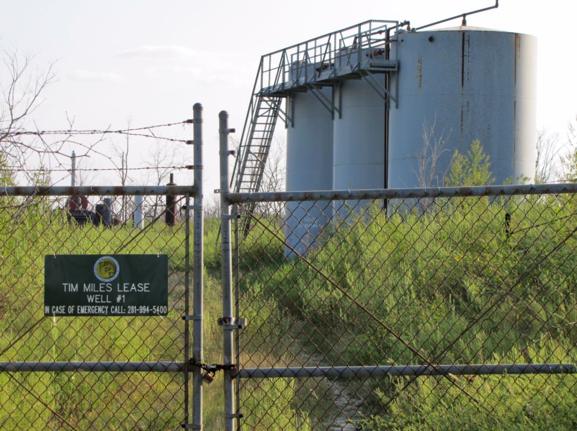 |
| Tim Miles Lease well site with oil tank |
In theory, you could continue to the West,
but if there ever was a road or trail there, it is now covered in chest-high
vegetation – at least during the warmer part of the year – and cannot really be
called a trail. I have not ventured beyond.
The trail is lined almost throughout its entire length by a trench running
North-South on the Eastern side, and one running West-East after the turn
(North of the trail).

These ditches fill with water after a good rain and are totally dry at other times. The segments of the Miles Lease Trail runs alongside what is designated a wetlands restoration area. This whole area was devastated by a large-scale bushfire in 2011.

These ditches fill with water after a good rain and are totally dry at other times. The segments of the Miles Lease Trail runs alongside what is designated a wetlands restoration area. This whole area was devastated by a large-scale bushfire in 2011.

All of the young trees on the open land are dead. Most still remain as charred skeletons. They create an eerie, yet inspiring, vista as the prairie grass and undergrowth is back is if nothing happened and furnishes a bed of green from which the charred trunks and branches jot up into the sky.

On a pretty day, this makes for a landscape in green, black,
and blue … and white … if there are some clouds too to complete the composition.
Gradually, the black deadwood is coming down during storms, and a few tree
limbs have fallen on the trail here and there.
When wet but not flooded, there will be puddles on the
gravel road and snakes may hang out near them, which is true of Noble Road trail
too. Watch your step. There are plenty of insects along the way. Of greatest
aesthetic appeal are the butterflies. The most common one seems to be the Gulf
Frittilary, which has different color and patterns on the upside and bottom
sides of its wings. The top side is almost solidly orange with a few specks,
the bottom side is white with more of a pattern.

Depending on the season, there
may also be Monarchs, Admirals, Buckeyes, and even Swallowtails.


Additionally, there are dragonflies
here too, as elsewhere in the area, but probably not as numerous as around the
lakes and waterholes unless the road-side ditch are flooded after heavy
rain. They like to hunt above the
surface and lay their eggs in shallow water.
 |
| Reddish (roseate) skimmer dragonfly |
 |
| Vegetation alongside the trail in Fall |

 |
| Overgrown access road to Tim Miles Lease oil well site inside Barker Reservoir |
Sunday, August 5, 2012
Don't mess with the lake in my neighborhood: Residents take on new corporate owner of commercial property to save their beloved Lake Thicket
Memorial-area home owners organize to stop developer from
draining neighborhood lake on land slated for re-development. Demolition of huge but obsolete office complex at South Mayde Creek Lane in the 15300 block of Memorial Drive is already well underway. The lake has been fenced off -- and no trespassing signs posted -- although the birds remain - for now.
 |
| Memorial Thicket home owners love "their" lake and have started campaign to stop new owner/developer from draining it: savelatethicket.org Also see blog: http://savelakethicket.blogspot.com/ |
 |
Neighbors fight for their recreation area next door:
Save Lake Thicket campaign sign on neighborhood fence on Memorial Drive
|
 |
| Location of large-scale demolition and re-development project: South Mayde Creek at 15200-15300 block South of Memorial Drive |
 |
| Transocean and Global Santa Fe used to occupy the buildings, which have now been vacant for many months |
 |
| A smattering of home-made sign express residents' sentiment |
 |
| Only shell of office building remains |
 |
| The site is close to Terry Hershey Park at Langham Creek and Memorial Loop segment of Terry Hershey Hike & Bike Trail |
Subscribe to:
Posts (Atom)