Thursday, January 30, 2014

Bicycle riders vs pedestrians on West Houston hike-and-bike trails: Can they get along?


HIKERS VS. BIKERS ON ENERGY CORRIDOR TRAILS

New warning signs on Terry Hershey Trail
telling bicyclists to mind the pedestrians
The West Houston trails are mostly, if not universally, multi-use trails. They are also getting extremely popular, especially on weekends; especially with nice weather, in other words all your round except at the heights of heat in the summer, and on a the few days cold days of winter, and the occasional rains. On gorgeous days as we are having them now, the parking lots alongside Highway 6 (at Briar Forest and at the point where Buffalo Bayou emerges from the reservoir through the flow-control gate) are not only filled to capacity; they are overflowing, with cars and trucks ending up on the grass and on unmarked portions of pavement. But the scarcity of parking space is not the only problem. The nonmotorized moving traffic is getting to be a problem too.

Park users on bikes vs those on foot     

The multi-use trail design approach has its problems. To be more specific, it is the collision of the interest of the cyclists and the hikers and walkers, if not literally: collision that is, of hiker and biker.  There is a posted speed limit of 10 MPH when passing pedestrians on the paved trails, but it gets routinely ignored. Some biker approaching from behind shout to announce their impending approach, as they are supposed to, but not all do. Only a few bicycles have hand bells. 

Nor is it clear how the speed limit or the park-etiquette rules could it be enforced, except after the fact, in a court of law perhaps, when it comes to determining liability for damages caused in a collision. Which is bound to happen. More should be done to prevent the harm before it occurs. More should be done in the way of prevention.

Incompatible interests 

Many cyclists are, or aspire to be, serious about their pursuit. They practice cycling as a sport. They go fast, and the 10 MPH speed limit does not suit them.

Dedicated bike and pedestrian paths, respectively, or territorial dominance by threat of speed?

Some segments of trail are already pretty much the preserve of the cyclists, such as the segments that run alongside Barker Dam on the foot of the outside slope from J.R. Hatch Park to the flow control gate at Highway 6 and continuing on heading South to Noble Road at Briar Forest.

Dam pedestrians have their own option: walk at their leisure the gravel road on top of Barker Dam, and enjoy the view: On one side the natural wilderness inside the reservoir; on the other, at the turn of the head, the panorama of what passes for the Energy Corridor's skyline.  
To the North, Diamond Offshore, the old and new Energy Crossing buildings, the TopGolf net, and the Wyndham Hotel beyond the SH6-Katy Freeway overpass. To the East: the buildings that make up the BP Campus in all their multi-chromatic beauty and the Eldridge Place Office Towers. Cyclists can take to the top, too, but it will take a dirt bike or mountain bike, and the maximum speed will be capped by the rough condition of the dam road surface. The same goes for Addicks Road Dam.

But the bike-vs-pedestrian situation on the Terry Hershey Park trails alongside Buffalo Bayou and the Memorial Loop Segment on both sides of Langham Creek above the confluence point is another matter. There is competition for foot and elbow room space there, and greater caution is paramount, pending a better physical trail plan design or viable nonmotorized traffic solution of regulatory nature.


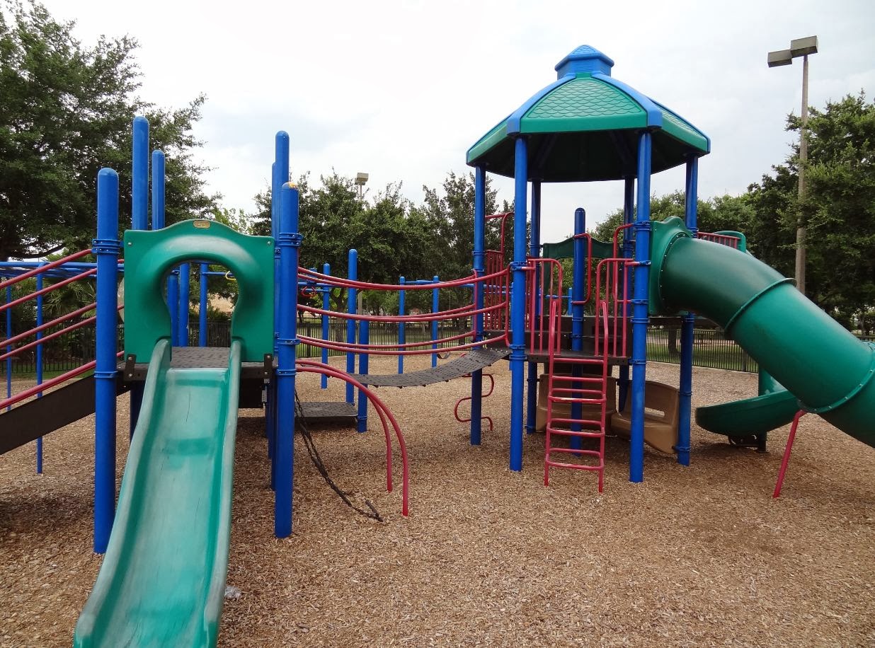
Not to mention that the children's playground areas (Kids Fit area and enclosed playground with playground equipment) are located on the West bank of Langham Creek between Memorial and Katy Freeway. The duck pond on the former Exxon campus is, separated by a chain-link fence on the West side of the park, is also a popular attraction for families with kids.  Perhaps bikes should be banned from that component of Terry Hershey Park altogether, as they are banned from segments of Memorial Park, such as the Seymore-Liebermann jogging trail, and the entire Arboretum and Nature Center area.


Boardwalk / bridge when not crowded
A Bottleneck: The Bayou Bridge in George Bush Park

Another problem area is the boardwalk across Buffalo Bayou on the Southern side. It's a great spot to watch the turtles sunning themselves on an old log in the water below, but the pedestrian bridge is fairly narrow, with railings left and right, which leave no room to take evasive action when a cyclist approaches at high speed from the West or from the East, not to mention different bikers coming for directions at the same time. At the same time, the bridge/boardwalk is a great place for families with kids to watch turtles, and may be oblivious of the danger of turning around and moving as little as a foot to one side.


That segment of the Bush Park trail is a veritable bottleneck and a predictable accident site. Horses are banned from the boardwalk, but cyclists are not; nor are they required to dismount. The only hint of a concern of the inherent risks of having pedestrians and bikes share a long narrow stretch of boardwalk are the 10 mile speed limits signs on both ends. 

The new warning signs posted along the trails in that area only advise of the dangers of wildlife, not of speeding bicyclists.


Unfortunately, there is no alternative to cross the Bayou and get to the other side. And cyclists need to cross somewhere to in order to enjoy the full stretch of paved trails to the equestrian area parking lot and up the abandoned Barker-ClodineRoad to Sergeant Hatch Park.


Nor is it realistic to expect that the County or U.S. Army Corps of Engineers will build a second bridge any time soon so that pedestrians and cyclists can be separated and cross safely at a distance to each other.

Can we all get along alongside?

Given the absence of alternatives to deal with the bottleneck, perhaps cyclists should be required to get off their bikes and push them across the ped-bike bridge, at least on weekends. It might even facilitate friendly communication between the two groups of park and nature aficionados whose interest otherwise collide, and whose ways of pursuing their respective recreational preferences don't otherwise lend themselves to trail talk, if any contact of the conversational kind. After all, at their typical respective speeds, the encounter of hiker and biker along the trail lasts but a moment, unless it results in a collision, which is the type of encounter to be avoided, not facilitated. Perhaps it is time to have a conversation. A conversation about safety for both hiker and biker. 


Saturday, January 25, 2014

MARKS LH7 RANCH site raized to make way for residential development


The sun is setting on what used to be Marks Ranch (LH7 Ranch) in Barker, TX

LH7 Ranch site prior to Developers and construction equipment moving in
Church in background
LH7 Ranch Texas Historical Commission Marker
Barker TX (near Addicks and Clodine)
Excavation on ranch site to serve as detention pond for development nearby;
historical structures, including a church in the distance (Feb 2014 photo)
BELOW: Site of Marks Ranch as it looked before start of construction
with historical marker and old photos on poster

Marks Ranch historical site in Barker Texas, with interpretive markers

Kingsland Blvd. South of I-10 near Barker-Cypress Rd.
Satellite view of LH7 Marks Ranch site before new development. Ranch buildings still visible on this image. The church seen in the thumbnail pic has been moved closer to Barker-Clodine Road and is being preserved, along with a couple of other old buildings, including Barker Post Office and General Store


Friday, January 24, 2014

The story of the train that once ran through George Bush Park and connected the ranches in Barker and Katy to Houston

This interpretive poster with an old black-and-white photograph of a steam-engine-drawn train and people on top, erected on the edge of the equestrian area parking lot, tells the tale of the small-gauge rail line that in pioneer days traversed the area now known as George Bush Park and connected it to Houston, which was then but a small town on the Bayou. 

A train one ran through the ranchland that is now wilderness
Relics and reminders of life before the U.S. Army Corps of Engineers 
built the dam and converted the ranch land to a reservoir can be seen throughout 
the wilderness area; some even along the paved trails running through the reservoir.


For those interested in the role railroad played in the settlement and development of the area, there is a railroad museum in nearby Richmond, TX, Fort Bend County, which may be worth a day trip.

A surviving specimen of a full-sized Southern Pacific steam locomotive can be seen in Downtown Houston. It is on display on a lot between George R. Brown Convention Center and MinuteMaid Ballpark Stadium.

Southern Pacific Steam Engine at site of future Nau Center
at MinuteMaid Park and Downtown Houston Convention Center


Thursday, January 23, 2014

Playgrounds and play areas for children in the Energy Corridor


Terry Hershey Park
on Memorial Drive between Eldridge and Highway 6
The enclosed playground with play equipment and the Kids Fit exercise area are part of the Terry Hershey Park and Trail System. The hike and bike trail extends to the Beltway in the East, and to George Bush Park in the West. The kid's section of Terry Hershey Park is located on Memorial Drive West of Eldridge Parkway, with parking on the South and access from the North over pedestrian bridges over Langham Creek from another parking lot adjoining Katy Freeway inbound feeder, that also serves hikers and bikers that want to use the new extension of Terry Hershey Trail to the North to Addicks Dam via Katy Freeway underpass. Watch out for cyclists on the trail, which is a rather narrow multi-use paved trail that can get very busy. The speed limit for cyclists is 10MPH, but is not always observed. 

Enclosed children's play area at Terry Hershey Park on Memorial Drive


Duck pond on corporate campus adjoining Terry Hershey Park to the West

Ray Miller Park on Eldridge Parkway
This is a small park on Eldridge surrounded by luxury apartment complexes. It features two enclosed play areas for kids of different ages; multiple pavilions, restrooms and a drinking fountain; a boardwalk is located at the center; and a walking path winds its way along the perimeters of this small recreational oasis. Picnic tables with BBQ pits are located throughout. Ray Miller Park is small but very popular with neighborhood residents. The parking lot off Eldridge is often filled to capacity. Dogs and bikes are not allowed in this park.


Drinking water fountain at Ray Miller Park near playground area at pavilion


George Bush Park South of Westheimer Parkway


This section of George Bush Park (named for first President Bush, who played a role in Buffalo Bayou wetlands preservation as then-congressman from Houston) is located South of Westheimer Parkway and accessible via South Barker-Cypress Boulevard. This is a large public park with vast surrounding fields. It has running water and restroom facilities and can accommodate large groups in pavilions for weekend get-togethers and special events. Pavilions can be reserved. Parking is not a problem here in this park, which serves all age groups and various interest, including aficionados of kite-flying. The surrounding flatlands are part of the reservoir and therefore flood after heavy rains. To the South, near the power line, is a duck pond with its own small parking lot, picnic tables and benches overlooking the lake, which is frequently visited by birds of various species throughout the year. Unlike other parts of Bush Park, such as Noble Road Trail, this area is open grassland, with only a few scattered trees, and thus exposed to the sun in the summer. 


OTHER PARKS: Cullen Park with multiple playgrounds, sports fields and facilities incl baseball and soccer; and picnic areas; velodrome; and Cullen Park Trail; Sergeant Hatch Sports Park (skateboarding and volley ball)

MAPS SHOWING PARK LOCATIONS

Duck lake and playground at George Bush Park - Westheimer Parkway / S. Barker Cypress Blvd.

Kids Fit Exercise Area at Terry Hershey Park next to former Exxon Campus
South of Katy Freeway
Aerial view of Ray Miller Park on Eldridge Parkway South of Briar Forest

Houston Farm and Ranch Club at Patterson Road off SH-6


The Houston Farm and Ranch Club participates each year in the Downtown Parade that kicks off Rodeo Season. This photos are from the 2014 parade.


Gate to Houston Farm & Ranch Club grounds and facilities on Patterson Rd
off Highway 
Old fire engine parked in meadow